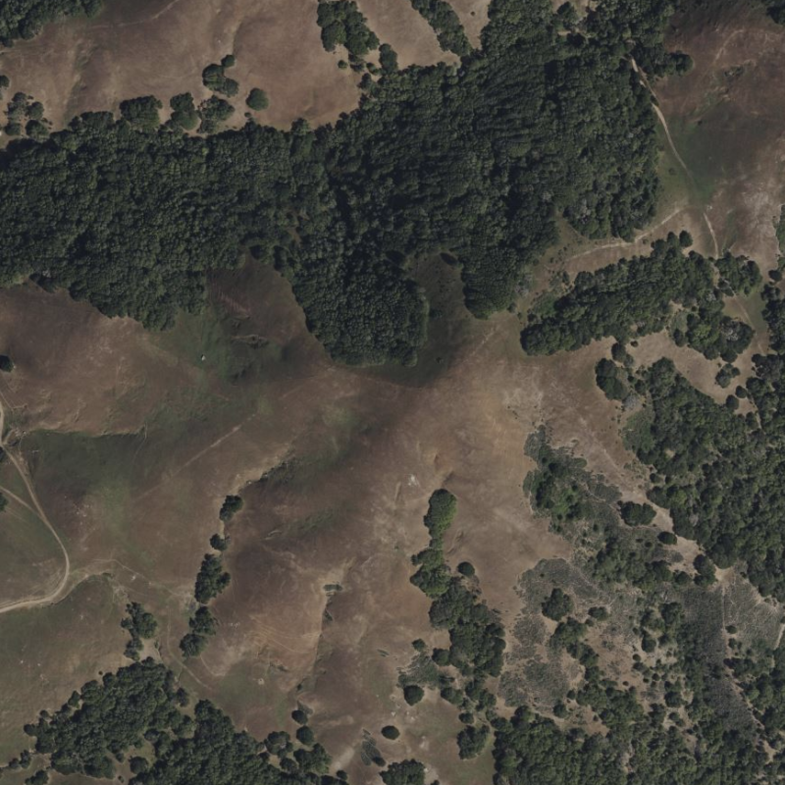
Most landowners divide their property into simple categories: the areas where things grow easily, and the problem spots they avoid. The steep section that's hard to mow. The shady north slope where vegetables never seem to thrive. The west-facing area that bakes all afternoon.
Here's what's actually going on: those areas aren't problems. They're just suited for different purposes — and you've been asking them to be something they're not.
One landowner spent years fighting a north slope, trying to get tomatoes and peppers to produce. Too cool, too shady, wrong conditions entirely. Then he stopped fighting and started paying attention. That same slope now grows specialty lettuce through the hottest summer months, when every other farm in the valley has bolted greens and empty beds. The steep south slope he'd written off? Mediterranean herbs — drought-tolerant, premium-priced, thriving in conditions he'd called difficult.
Nothing about the land changed. What changed was understanding what each area was naturally suited to do.
That's what aspect analysis gives you.
In this article, we'll cover:
• The physics of why slope direction matters for solar energy distribution
• How north, south, east, and west slopes behave differently on the same property
• Matching crops, buildings, and solar installations to the right aspects
• Reading your property's aspect distribution to inform planning decisions
• How slope steepness and direction work together to create microclimates
• Practical strategies for working with (not against) your land's natural patterns
What Is Aspect Analysis and Why Does Slope Direction Matter?
Aspect is simply which direction a slope faces. North, south, east, west, and everything between. Simple measurement — but it drives surprisingly large differences in how land behaves, and the reason comes down to basic physics.
The sun sits low in the southern sky in the northern hemisphere — never directly overhead outside the tropics. When sunlight strikes a surface at a steep angle, close to perpendicular, the energy concentrates. When it strikes at a shallow angle, the same energy spreads across a larger area and each square metre receives less of it. Think of shining a flashlight straight down onto a table — tight, bright circle. Now tilt the table away from you. Same flashlight, same output, but the beam spreads into an oval and the light gets dimmer across the whole surface.
A south-facing slope tilts toward the sun's path. It's effectively angling itself into the beam, the way you'd tilt a solar panel to face the sun directly. A north-facing slope tilts away from it — same sun, but the light arrives at a shallower angle and spreads across more surface area. The energy per square metre drops significantly. On a steep north-facing slope in winter, the sun may only graze the surface for an hour or two before the angle becomes so oblique that almost nothing is being absorbed at all.

Equal amounts of incoming solar radiation spread across different surface distances depending on slope direction: 1.0 m (3.3 ft) on south-facing slopes versus 2.0 m (6.6 ft) on north-facing slopes in the northern hemisphere. The same sunlight, diluted across twice the surface area — which is why north slopes receive roughly half the solar energy per square meter. In the southern hemisphere, the pattern reverses: north-facing slopes receive concentrated energy while south-facing slopes receive diffuse radiation.
This is why the gaps are real and measurable: up to 40% more solar energy on south-facing ground[1], soil temperature differences of 6–8°C (10–15°F) between exposures on the same property[2], and weeks of variation in when frost clears and when soil warms enough to plant. The 40% figure isn't a rough estimate — it's a direct consequence of the geometry. The slope angle compounds the effect further: a 15-degree south-facing slope in a mid-latitude climate receives roughly the same annual solar radiation as flat ground several hundred kilometres closer to the equator[3].
That last part matters more than most people realize. A property listed as "Zone 6" on regional growing guides might actually contain Zone 5 conditions on its north slopes and Zone 7 on protected south-facing ground. That's a full growing zone of difference — on the same parcel, sometimes within a few hundred metres of each other.
Your eyes can tell you one area is sunnier than another. What they can't tell you is where exactly the transitions fall, what percentage of your land faces each direction, or which specific spots combine good sun exposure with workable slope angles. Aspect analysis maps those invisible patterns across every part of your property.
How South, North, East, and West Slopes Behave Differently on the Same Property
South and southwest aspects are the thermal engines of your property. They receive maximum daily sun, warm up earliest in spring, and hold warmth latest into fall. Soil temperatures here can run 6°C (10°F) higher than north-facing ground just a few hundred metres away. These are your natural solar zones — ideal for photovoltaic installations (30–40% more efficient than flat-ground placements), heat-loving crops like tomatoes, peppers, and dry-farmed grains, Mediterranean herbs that thrive in heat and well-drained soil, and any passive solar structure where you want the sun to do the work. The main thing to watch is summer heat stress and water demand — south slopes dry out fastest and can overheat crops that aren't selected for them.
North and northeast aspects are the opposite, and that's valuable in its own right. Indirect light most of the day means consistent cool temperatures, extended moisture retention, and conditions that cool-season crops love. Lettuce and greens that bolt on south slopes in July keep producing on north-facing ground. Mushroom cultivation thrives in the consistent humidity. Shade-tolerant woodland crops — ginseng, goldenseal, ramps — are often worth more per square foot than any vegetable you could grow on the sunny side. There's also a timber argument: shade-tolerant species grown on north slopes tend to produce tighter grain and straighter form, which commands premium prices in some markets.
North slopes also provide built-in climate resilience against spring frost damage — a benefit that's becoming more valuable as spring weather patterns become less predictable. Plant the same species on both south and north-facing slopes: during an early warm spell, south-facing slopes warm faster and trigger budding first. If a late spring frost follows, those early buds get killed and the crop is lost. Meanwhile, the same trees on the north slope haven't budded yet — the slower spring warm-up that seems like a disadvantage actually protects yield by keeping plants dormant through dangerous frost windows.
The tradeoff is that slower spring warm-up means a delayed growing season start and potential drainage issues where moisture sits longer than it should — though as noted above, that same delayed warm-up provides valuable frost protection in exchange for the later start.
East and southeast aspects occupy a middle ground that suits a wide range of uses. Morning sun warms the soil gently and sets plants up for the day; afternoon shade reduces heat stress and water demand. Fruit orchards particularly like this combination — apples, stone fruits, and pears benefit from the morning warmth without the afternoon intensity that stresses them during setting. General vegetable production does well here too, as does greenhouse placement, where natural light without overheating is the goal. One thing to watch: rapid morning warming after a cold night can sometimes damage frozen plant tissues before they've had a chance to thaw slowly.
Southwest and west aspects receive the most intense thermal loading on most properties. Southwest slopes catch direct sun from roughly midday through sunset, combining high sun angles with peak afternoon temperatures for maximum heat accumulation — often making them the hottest aspect overall. West slopes receive afternoon sun during the warmest hours, though without the midday component southwest gets. Both create specific opportunities: mature drought-adapted plants often thrive here once established, though the establishment phase requires careful attention since the afternoon heat that benefits mature plants can stress or kill young ones without adequate water and occasional afternoon shade. Solar thermal systems — hot water collectors specifically — benefit from the sustained late-day heat these slopes capture. Storage buildings placed here tend to stay naturally dry from the afternoon warmth. The challenge is that these aspects often get dismissed entirely, when the real answer is being selective about what you put there.
If you want to see which direction your slopes face — and where the best combinations of aspect and angle cluster on your property — run the analysis on your parcel →
How to Match Crops, Buildings, and Solar to Your Property's Slope Direction
Once you can see aspect mapped across your property, mismatches become obvious. The garden plot on the north slope struggling to ripen tomatoes isn't a pest problem or a soil problem — it's a placement problem. Move the tomatoes south, put salad greens in their place, and both do better with less effort.
The same logic applies to infrastructure. A home on a north-facing slope fights a constant uphill battle on heating costs. The same house on a south slope with proper window placement gains free winter heat. A solar array on flat ground produces decent power. The same panels on a south-facing slope at the right angle produce 30–40% more over their lifetime — which on a $20,000 installation works out to $6,000–8,000 in additional energy production over two decades.
Staggered harvests. Plant the same crop on different aspects and your harvest window stretches automatically. Lettuce on the south slope bolts first as summer heats up. The north slope planting keeps producing weeks longer. Plant both, and you've extended your season without any special equipment or infrastructure.
Specialty positioning. North slopes that can't compete for heat-loving crops can dominate in products that need consistent cool conditions. Gourmet mushrooms in shaded north-slope production can return $4–8 per square foot net annually for outdoor log production, with lifetime per-log returns of $15–20 over 3–4 productive years[4] — well above most vegetable crops. The north slope that was your lowest-performing area might be your highest-value land once it's matched to the right enterprise.
Building site selection. Different purposes want different exposures. Primary residence? South slope for passive solar heating. Workshop needing consistent, glare-free light? North slope. Livestock shelter? East slope for morning warmth with afternoon shade options. Storage building? West slope, where afternoon warmth reduces humidity and condensation. Aspect analysis doesn't just reveal where to build — it reveals which structure belongs where.
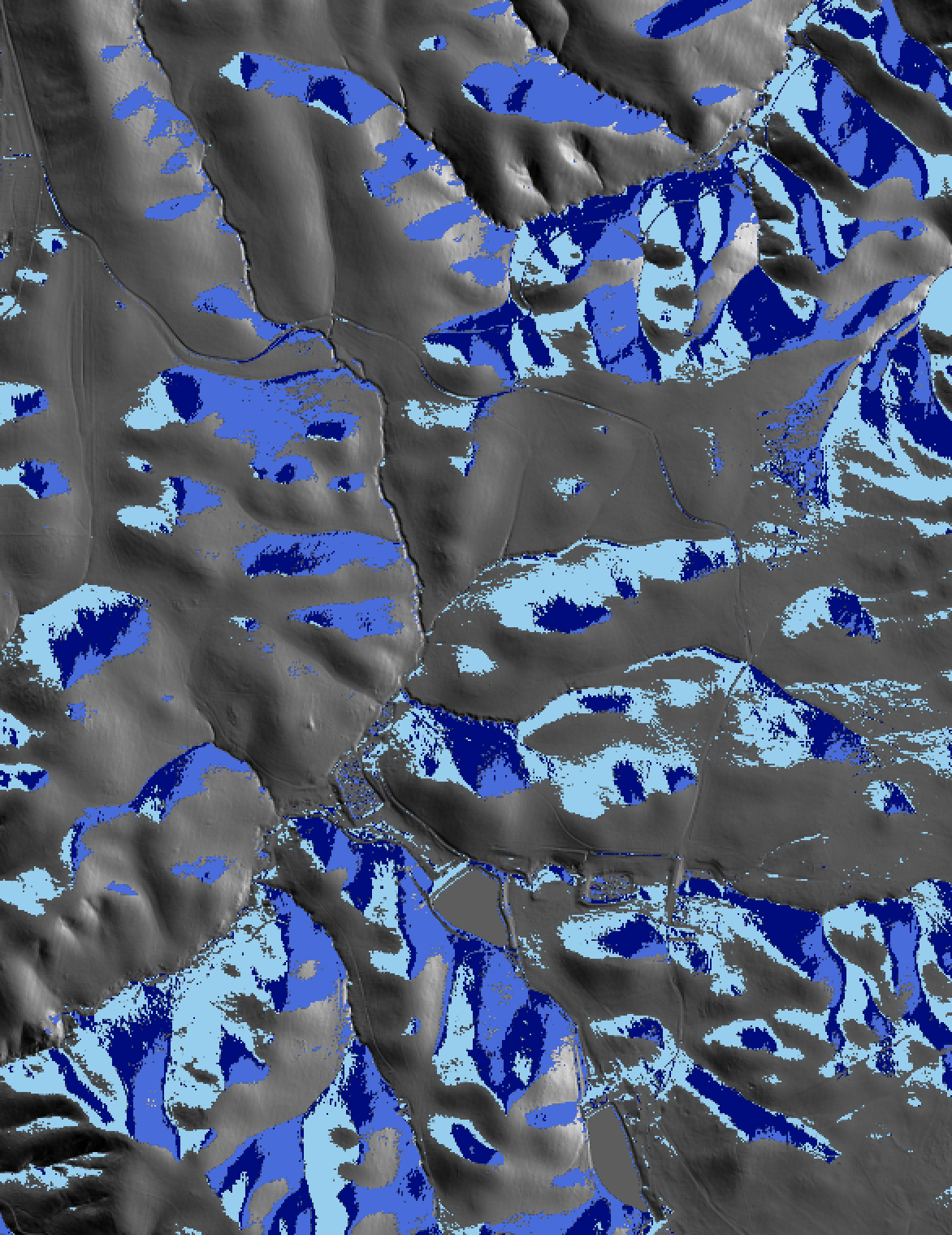
Isolating the aspects that matter to you. Once you've decided which direction you're optimizing for, the next question is always: how much of it do I actually have, and exactly where is it? In LandScope you can toggle individual aspect directions on and off, so the map shows you only the ground you're actually evaluating.
If you're planning a mushroom operation, turn off everything except north and northeast. What's left is your candidate area — you can see immediately whether it's one contiguous block or scattered pockets, whether it connects to water, whether the slope is workable for the infrastructure you'd need.
South and southwest are worth isolating for a different set of reasons. This is your warmest, earliest-thawing, highest-solar-input ground — the land that warms up first in spring, dries out fastest after rain, and receives the most accumulated heat through the growing season. Toggle to just south and southwest and you're looking at your prime real estate for heat-loving crops, passive solar building sites, and solar installations. More practically, you're also looking at your early-access ground — the areas you can get equipment onto before the rest of the property has thawed. On a larger acreage, that's not a trivial detail. Knowing exactly where your south-facing ground is, how much of it there is, and whether it's contiguous or fragmented tells you a lot about what's actually feasible before you commit to a plan.
The same filtering logic applies to any direction you're working with. East-facing ground for an orchard, west-facing for a windbreak or thermal mass structure — toggle to the aspects that matter for the decision in front of you, and the viable area becomes visible without having to mentally parse a map showing everything at once. This matters most when you're making a case to someone else — a partner, a contractor, a lender — and you need to show them specifically what you're working with, not hand them a full colour-coded map and ask them to interpret it.
Want to see your site's aspect distribution before your next project?
Free 20-minute demo. We'll map your site (or a similar site if your data isn't immediately available) and explore aspect analysis plus LandScope's many other terrain insight layers.
What Your Aspect Distribution Reveals About Your Land
Every property has a unique mix of aspects. Some are predominantly south-facing with small north pockets. Others tilt mostly north with limited sunny ground. Knowing your distribution answers practical questions before you commit money to the wrong plan.
How much solar potential do you actually have? If only 10% of your acreage faces south at usable angles, a large solar installation doesn't make economic sense. A smaller, precisely positioned array does. Knowing this before you get a solar quote is worth something.
Where are your premium building sites? In temperate and cold climates, south-facing lots have commanded premiums of roughly 7–14% over comparable north-facing ground[5]. A detailed aspect map might reveal two or three distinct premium sites on a property you thought had one obvious location.
What enterprises fit your land? A property dominated by north-facing terrain won't support large-scale heat-loving crop production — but it might be ideal for timber, mushrooms, or cool-season specialties. A mostly south-facing property has entirely different strengths. Aspect analysis makes this visible before you've spent two seasons finding it out the hard way.
Where are current uses mismatched? The underperforming garden, the solar panels producing less than projected, the building that's always too hot or too cold — aspect often explains exactly why, and points directly at where those uses should have gone instead.
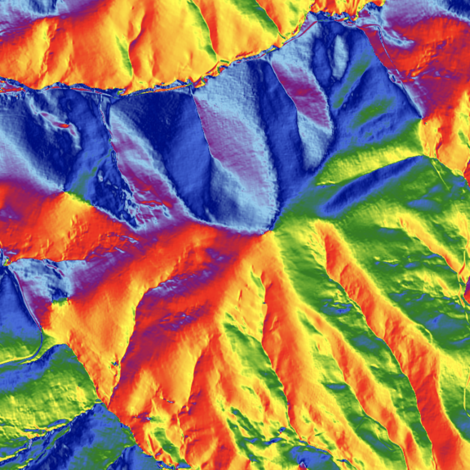
Why Slope Steepness and Aspect Direction Work Together — and How to Read Both at Once
Direction matters, but so does steepness. A gentle south-facing slope behaves differently than a steep one facing the same direction — and the combination of the two tells a different story again.
LandScope's composite analysis maps both at once: colour shows direction, intensity shows angle. A steep south slope appears deep red. A gentle north slope shows pale blue. This makes the combinations that matter most immediately visible.
The sweet spots are the "just right" combinations. Moderate south slopes — roughly 8 to 15 degrees — work perfectly for solar installations, providing enough angle to optimize capture without being so steep that maintenance becomes difficult. Gentle east slopes in the 3 to 8 degree range suit orchards well, combining morning warmth with manageable cultivation and good cold air drainage. Flat ground near water in a north-facing hollow? That's often your best spot for a cold-storage structure or mushroom operation.
The trouble spots cluster predictably too. Steep west slopes combine intense afternoon heat with difficult access — useful for some things, challenging for most. Very gentle terrain in any direction often has drainage considerations. The composite view shows where challenging combinations concentrate and where favorable ones overlap, which is the information you actually need when you're deciding where to sink money into infrastructure.
This is also where aspect analysis earns its keep for people who have already made commitments. If a building or enterprise is underperforming, the composite layer usually explains it — and often points to a nearby site that would have been better.
Why Working With Slope Direction Beats Fighting It
Most landowners treat their property as a single unit with uniform potential. Plant the same things everywhere, build wherever seems convenient, then try to figure out why some areas always struggle.
What aspect analysis reveals is that the struggle was always going to happen. Your north slope isn't failing — it's succeeding at being a north slope. It's doing exactly what north slopes do: holding moisture, staying cool, growing things that want those conditions. Put it to work doing that well, and it becomes productive. Keep demanding it perform like a south slope, and you'll keep being frustrated by it.
Your north slope holds moisture and stays cool — so plant things that want moisture and cool. Your south slope dries fast and heats up early — so put your heat-loving crops and your solar there. The land is already doing something. Match your plans to what it's doing and most of the effort disappears. The permaculture framing — observe and interact before you intervene — applies directly here. Aspect analysis is the observation layer. It shows you what the land is already doing before you decide what to do with it.
The result is less effort, lower input costs, better yields, and infrastructure that performs instead of struggles. The land was always going to behave this way. Now you're building with that instead of against it.
How to Use Your Aspect Map Before Your Next Building, Garden, or Solar Decision
The sun hits your property the same way every day, creating patterns you can either work with or ignore. Aspect analysis makes those patterns visible — which directions your slopes face, what percentage falls in each category, where the favorable combinations are, and where current uses don't match what the terrain is suited for.
Every decision about where to build, what to grow, and how to develop your land gets clearer when you can see what the terrain is already telling you.
Ready to see what your site is suited for?
Free 20-minute demo. We'll map your site (or a similar site if your data isn't immediately available) and explore aspect analysis plus LandScope's many other terrain insight layers.
References
[1] NREL (National Renewable Energy Laboratory). PVWatts Calculator. https://pvwatts.nrel.gov
[2] McKee, T.B., Doesken, N.J., and Kleist, J. (1965). Microclimate Conditions Found on Highway Slope Facings as Related to Snow and Ice. Highway Research Record, 93. Transportation Research Board. USDA Agricultural Research Service slope aspect soil temperature studies.
[3] NREL (National Renewable Energy Laboratory). PVWatts Calculator (modeled data). https://pvwatts.nrel.gov
[4] Cornell Small Farms Program / USDA-SARE. Shiitake Mushroom Production on Logs. https://smallfarms.cornell.edu. Maine Organic Farmers and Gardeners Association. USDA National Agricultural Statistics Service (2025). Mushrooms. NASS Agricultural Statistics Board.
[5] Wang, D., Li, V.J., and Yu, H. (2019). The value of a south-facing orientation: A hedonic pricing analysis of the Shanghai housing market. Journal of Urban Management, 8(3), 367–377.