Most people think land analysis requires a GIS team, a surveyor, or a week of fieldwork. The standard advice is to hire professionals, walk the property multiple times across different seasons, and hope the seller disclosed whatever they know about the terrain.
That's not how I do it.
Before I get emotionally attached to a listing, let alone book a site visit, I run through four terrain layers. Each layer answers a specific set of questions, and together they tell me whether a property is worth pursuing or whether I should move on before I've invested any more time. At the end of the day, it's a filter. Four layers that tell me whether a property is worth the cost and time of professional due diligence, before I've committed to either.
Layer 1: Where Drainage Water Moves and Where It Collects
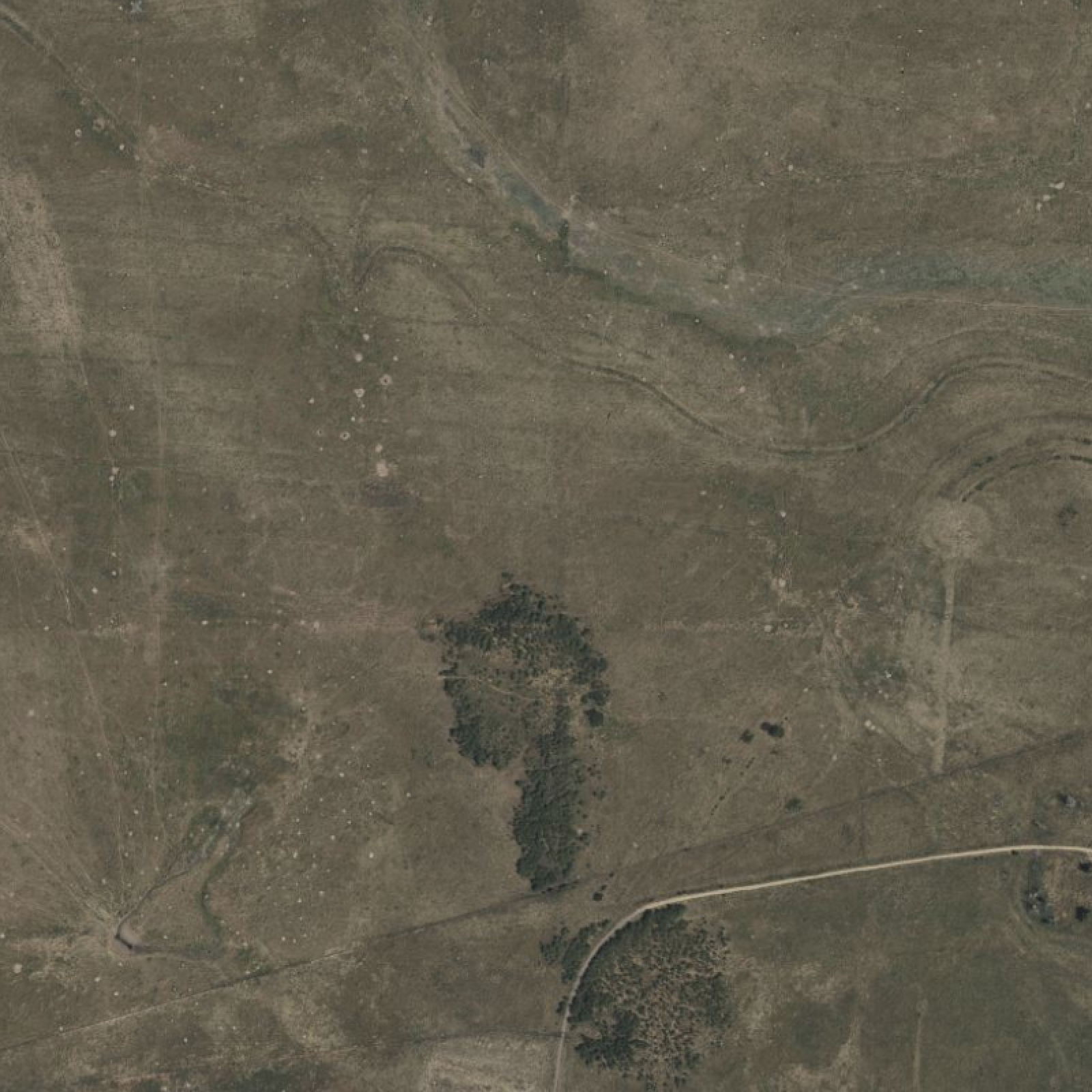
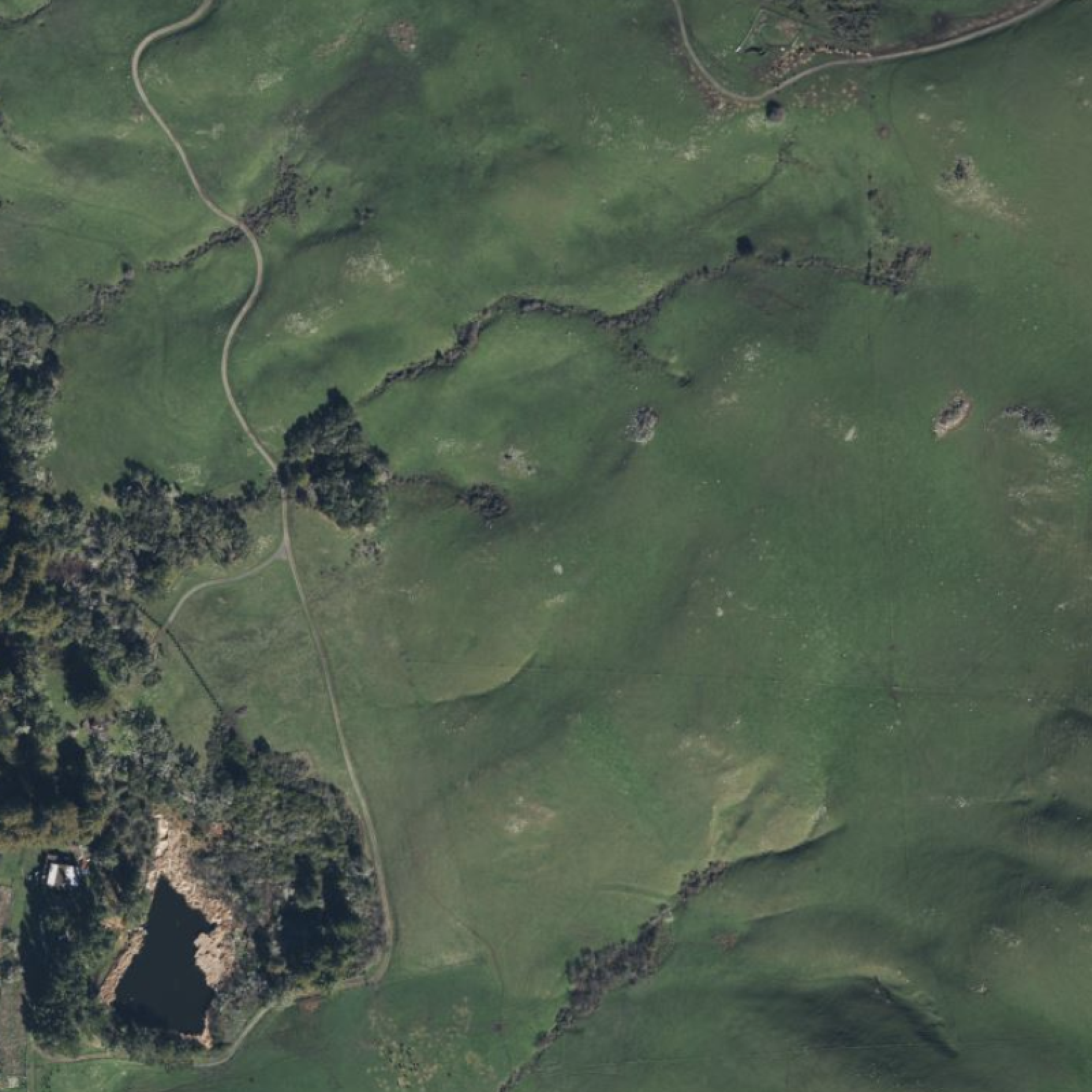
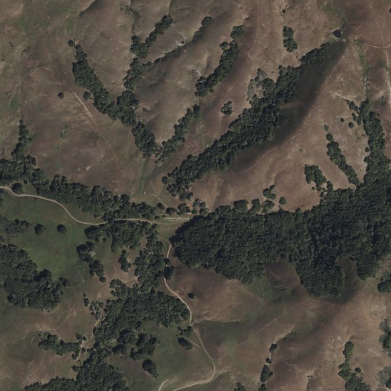
The very first thing I look at on any parcel is water behaviour. I'm not looking at the creek on the listing photos or the Google Earth Pro aerial image (though those are important). I am looking at the invisible drainage system that governs how the entire property functions after a big rain or snowmelt event.
This is the layer that catches the properties people regret buying by showing the soggy corner that stays boot-sucking wet until June, the "two small ponds" that turned out to be drainage ditches, or the building site that looks logical on a sunny day in July but sits in a low spot that collects water from half the neighbourhood every spring. These things don't show up on a site visit, but they do show up in your first wet season after closing.
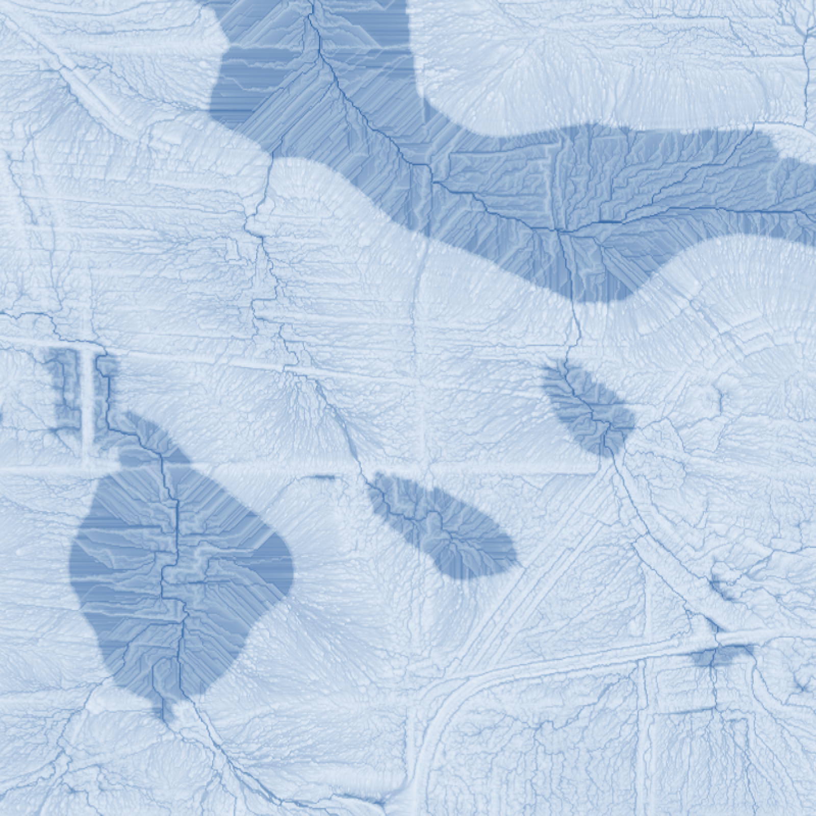
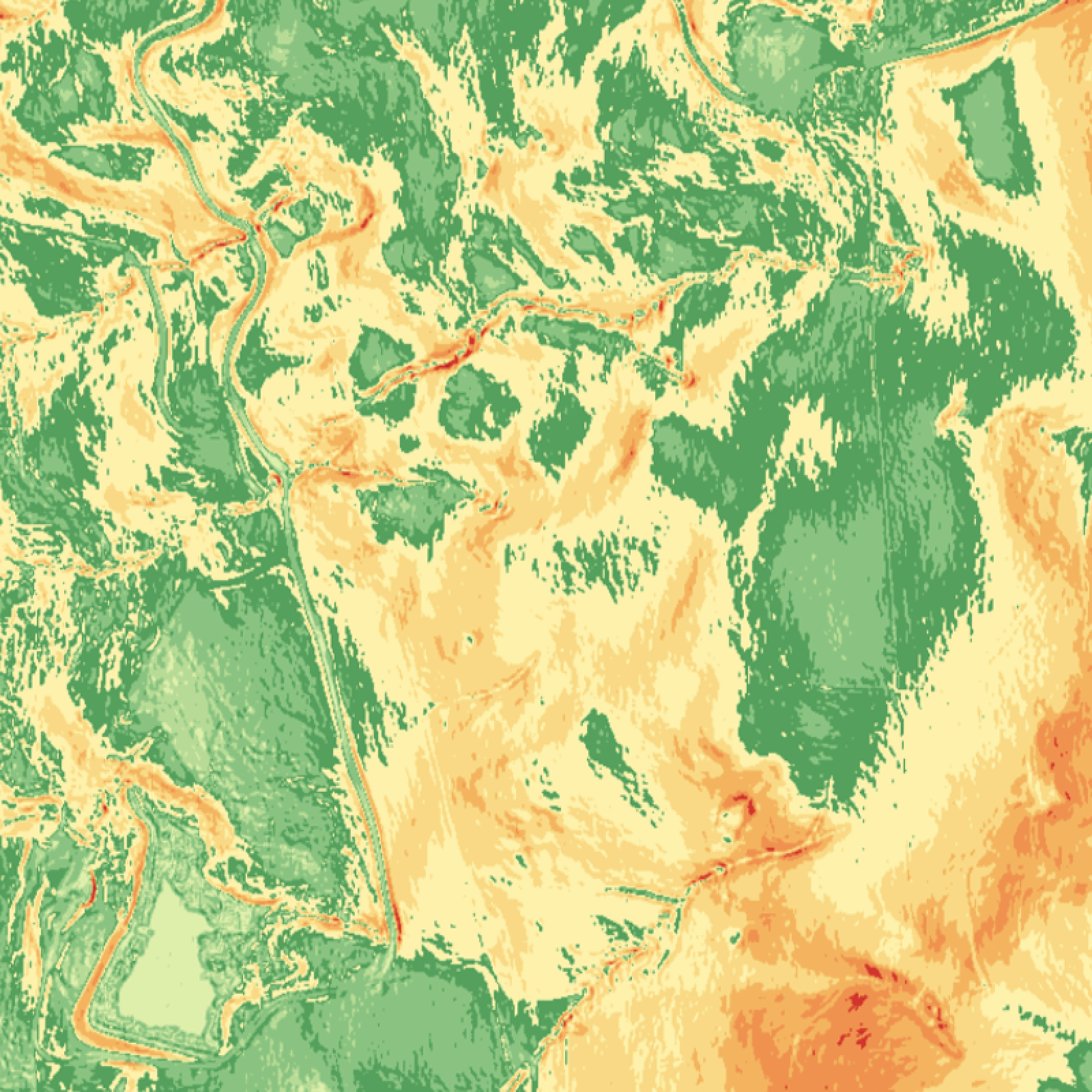
Two LandScope layers do most of this work: the Topographic Wetness Index (TWI) and the flow accumulation map.
The TWI is a heat map of where water wants to pool based on the shape of the ground. High TWI zones are areas where the terrain concentrates moisture: broad flat hollows, the inside of curves on a slope, anywhere a large area of uphill land drains toward a narrow outlet. These zones will be soggy regardless of what you do to them. They were wet before the current owner bought the property, and they'll be wet after you do. The water just sits there because the terrain says it should.
These are the spots that want to be a pond. Hint: the best place to put a pond is where a pond wants to go, the worst place to put a house or road is where a pond wants to go.
Flow accumulation shows the drainage network: the paths water actually follows when it moves across the land. Think of it as the property's invisible plumbing, calculated from the elevation surface rather than observed after a rainstorm. This is what tells you whether a wet corner is draining its own rain or collecting runoff from someone else's land uphill.
Those two layers answer the questions that matter most before an offer:
Has the house, garage, or other infrastructure been placed in a spot that would rather be a rain garden or a pond?
A building site that looks logical from the road can sit directly in a high-TWI zone. The drainage problems won't become obvious until the first wet spring after closing. By then you've paid a surveyor, an inspector, and a lawyer, and none of them flagged it because none of them were looking at terrain data.
Where is the water coming from, and where is it going?
A parcel doesn't drain in isolation. It receives runoff from uphill land, sometimes from a surprisingly large contributing watershed that extends well beyond the property boundary. The realtor often has no idea. The seller often has no idea either. They've just never seen it mapped. Knowing whether the contributing area draining toward the low corner is 5 acres or 150 acres changes the conversation entirely.
How much of the property is going to stay soggy after a significant rain event?
Some wet areas are temporary and workable. Others are chronic. The difference isn't always obvious from a listing photo or even a site visit in a dry month. It's right there in the TWI distribution across the parcel, available before you've spent a dollar on due diligence.
See the TWI and drainage network on any parcel
Free 20-minute demo. We'll map your site (or a similar site if your data isn't immediately available) and walk through TWI, flow accumulation, slope, aspect, and hillshade together.
Layer 2: Slope Analysis — How Steep the Land Actually Is
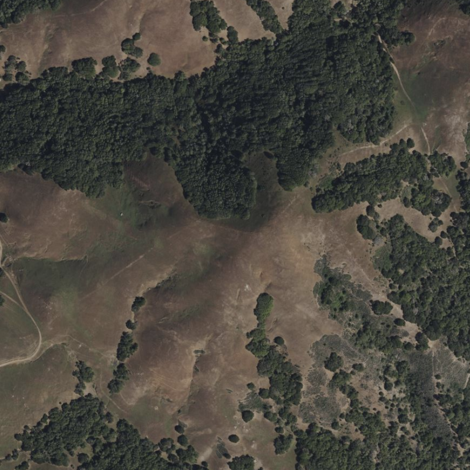
"Flat" in a listing description and flat on the ground are two different things.
Steep or soggy sites make construction expensive, and that line shows up over and over in land buying guides because experience keeps confirming it. While soggy parts get most of the attention, the slope part quietly causes just as much trouble, because it's even harder to evaluate on a site visit. You walk the land, it feels manageable, and then you find out the county won't approve a septic field where you planned it, or the driveway grade you need doesn't clear the permit threshold, or the "flat farmland" in the listing rolls just enough to put the obvious building envelope in a drainage channel.
A LandScope slope analysis gives me the percentage grade across every part of a parcel at 1-metre resolution. That resolution matters: a 10-metre or 30-metre DEM averages out the subtle grade variations that determine whether a specific location is workable or not.
Three questions the slope layer answers:
Is the "flat farmland" on the listing actually flat, or does it roll enough to create drainage challenges and limit equipment access? And conversely, is there a clear navigable path through the property that the listing photos didn't show?
Where are the grades too steep for a driveway, a building site, or a septic field?
Most jurisdictions have maximum grade requirements for these. A slope map makes the constraints visible immediately, which is especially useful when evaluating a property where the seller hasn't done a formal site assessment.
What percentage of this parcel is actually workable for the intended use?
Total acreage is a starting point. Usable acreage — the portion that's flat enough, dry enough, and oriented correctly for what you're planning — is the number that actually drives value. These two figures can be dramatically different on complex terrain.
Layer 3: Slope Aspect — Which Direction Every Part of the Property Faces
Slope aspect tells me which direction every part of the property faces. That sounds like a minor detail until you realize it drives the temperature, moisture, frost timing, and solar exposure of every zone on the property, often more than the regional climate does.
On a mid-latitude property in the northern hemisphere, a north-facing slope and a south-facing slope separated by even as little as ten metres can behave like two different growing zones. The south-facing ground warms first in spring, dries fastest after rain, and accumulates the most heat through summer. The north-facing ground stays cooler, holds moisture longer, and can extend cool-season crop windows well into summer heat. Both are assets. You just need to know where they are and what they're suited for.
Here are the three things I'm checking on aspect:
Is the house site facing south to catch winter sun, or is it tucked against a north-facing slope that stays cold and shaded for most of the day?
Passive solar potential is essentially free heating, while ignoring it in a building site decision is a decades-long mistake.
Where are the warm, sheltered slopes that would suit a garden, orchard, or grazing area?
The productive zones on a property aren't always where the flat ground is. Sometimes a moderate south-facing slope is more valuable agricultural ground than a flat north-facing field.
Where does the land bake in afternoon heat?
West and southwest aspects take the hardest afternoon sun. That matters for livestock, for crop selection, and for buildings that weren't designed with that exposure in mind.
A single property can contain four or five distinct microclimates. Aspect analysis shows where each one is, and whether the existing or planned infrastructure is sitting in the right one.
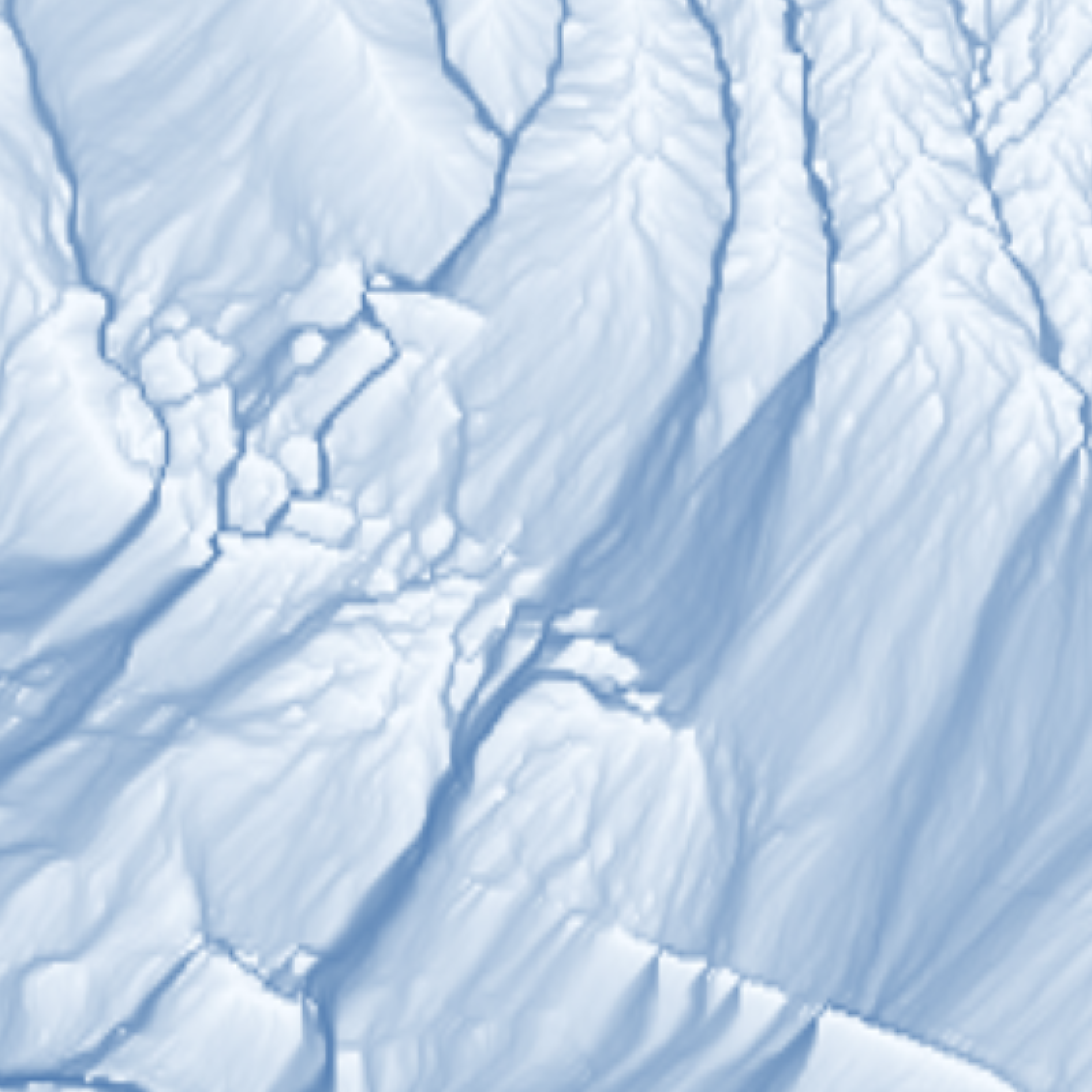
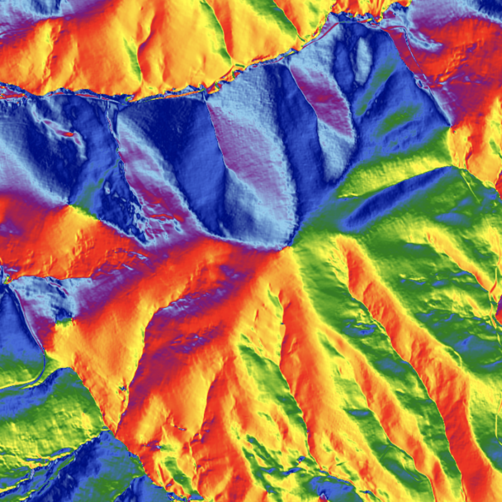
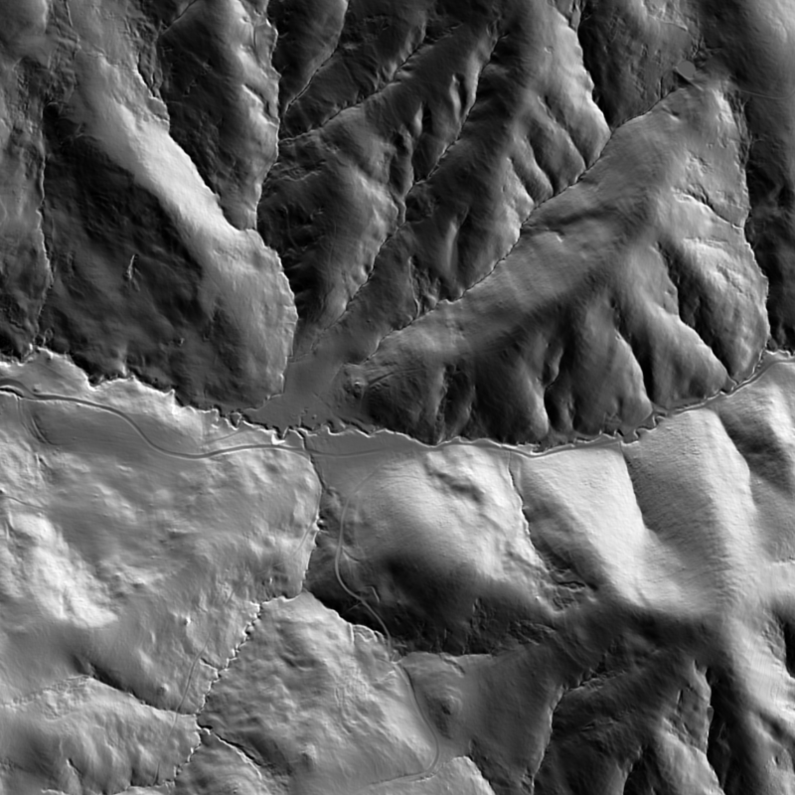
Layer 4: Hillshade — What LiDAR Reveals Under the Vegetation
The last layer I run is hillshade, which is almost like an x-ray for land done by simulating angled light to create a relief rendering. In heavily forested or overgrown areas especially, it shows features that even high-resolution aerial imagery can't resolve, because aerial photography sees the top of the vegetation canopy, not the ground beneath it. The LiDAR that LandScope uses penetrates that canopy, and the hillshade renders what the LiDAR found.
Four things I'm specifically looking for with a hillshade layer:
Old paths, rail lines, or access routes running through the property that don't show on any current map. These show up as subtle linear depressions or ridges in the hillshade. Sometimes they're valuable: a forgotten access corridor that improves a landlocked parcel. Sometimes they're complications: an old right-of-way the current owner doesn't know about.
A pond, depression, or abandoned structure sitting under tree canopy. Surface water features that aren't visible on aerial imagery are almost always visible in hillshade. So are old foundations, berms, and earthworks.
Erosion cuts or gullies forming on slopes that tall grass is masking at ground level. These are the terrain problems that a site visit in summer, with grass at waist height, simply won't reveal. A gully that's actively cutting headward into a slope is a drainage and stability problem. The hillshade shows it. The listing photos don't.
Buyers walk a property and see what's visible at eye level, in the season they visit, with whatever the vegetation is doing that day. Walk 40 acres in August with grass at waist height and you'll see about 10% of what's actually there. Hillshade shows what the vegetation is covering up before you own it.
How to Decide Whether a Property Is Worth a Site Visit
If the site holds up — drainage makes sense, slopes are workable, the aspect is right for the intended use, the hillshade doesn't surface any surprises — we dig deeper. Detailed hydrology, contributing watershed analysis, slope percentage breakdowns by zone, soil overlays.
If it doesn't hold up, we don't book a site visit. We move on.
This is exactly what happened with a property Madi and I had been watching in New Zealand. Years of seeing the listing, wondering "what if". When we visited her family recently, we talked about going to see it in person, but I mapped it out first.
The flow accumulation layer told us the obvious building site was in a chronic accumulation zone. The flow accumulation showed a substantial contributing watershed draining across the proposed garden area from upstream. The slope analysis showed the access route had grades that would be a problem in a wet winter. Nothing catastrophic in isolation — but three separate drainage concerns stacking on the same parcel, on land we'd been romanticizing for years.
We didn't book the site visit, and the property has since sold. We're very much at peace with that.
The map didn't kill the dream. It saved us from a purchase we'd made with our imagination instead of our eyes.
Want to run this read on a parcel you're currently evaluating?
Free 20-minute demo. We'll map your site (or a similar site if your data isn't immediately available) and run the four-layer terrain read live.
Frequently Asked Questions
"Do I need GIS experience to run these layers?"
No. LandScope generates TWI, flow accumulation, slope, aspect, and hillshade from LiDAR automatically when you draw a parcel. You don't process any data — you read maps that are designed to be interpreted without a GIS background.
"How accurate is LiDAR-derived terrain data compared to a professional survey?"
LiDAR-derived DEMs used in LandScope are typically accurate to within 10–15 centimetres vertically, sourced from state and provincial acquisition programs — the same datasets civil engineers use for drainage design. For pre-offer screening, this resolution is more than sufficient. For engineering design or legal boundary work, you'll still want a licensed surveyor. LandScope tells you whether that survey is worth ordering.
"Can I run this on any property in the US or Canada?"
LandScope covers parcels across the United States. Coverage varies by state based on LiDAR acquisition availability — most of the continental US has high-resolution LiDAR coverage. You can draw any parcel and see immediately what's available.
"What if the property I'm looking at is mostly flat? Is terrain analysis still useful?"
Flat terrain is often where terrain analysis matters most. Subtle grade variations that are invisible on a site visit — a 1% cross-slope, a shallow depression, a gentle catchment hollow — determine exactly where water accumulates on otherwise flat land. These features show up clearly in TWI and flow accumulation at 1-metre resolution but are nearly impossible to see by eye or on standard mapping tools.